 vesseltracker.com
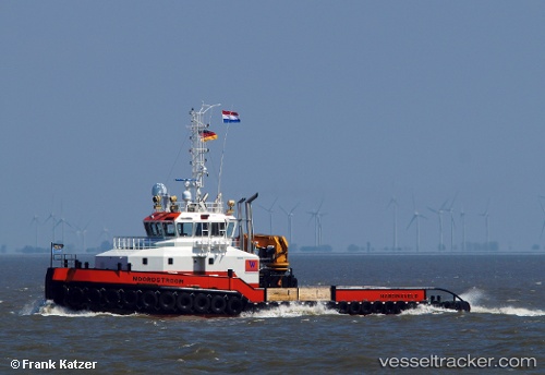
 Noordstroom
Current Status
Where is the vessel?
Noordstroom is currently in Near MAASVLAKTE - ROTTERDAM, based on AIS data received less than 1h ago.
Latest AIS update:
Current position: 51.91658° N, 3.97292° E (Near MAASVLAKTE - ROTTERDAM)
Average speed (last 7 days): Loading…
Average speed (last 30 days): Loading…
Vessel profile: Noordstroom is a Tug with dimensions 35m x 12m.
This page combines live AIS, route history, probable destination signals, nearby traffic, and port activity for practical vessel monitoring.
The current position of vessel Noordstroom is 51.91658 lat / 3.97292 lng. Updated: 2026-05-14 11:37:59 UTCNearest reference points:
- Near MAASVLAKTE - ROTTERDAM
- Near Haarlemmermeer
- Near Rockanje
Currently sailing under the flag of Netherlands ![]()
Details:
Live Vessel Noordstroom Analytics (details, animations, etc.)
Recent AIS points (UTC):
2026-05-14 08:25:28 UTC · 51.99552, 3.96850 · SOG 7 kn · COG 225°2026-05-14 10:14:08 UTC · 51.91646, 3.97219 · SOG 0.2 kn · COG 327°
2026-05-14 10:42:08 UTC · 51.91648, 3.97368 · SOG 0.7 kn · COG 317°
2026-05-14 11:37:59 UTC · 51.91658, 3.97292 · SOG 0.1 kn · COG 323°