 vesseltracker.com
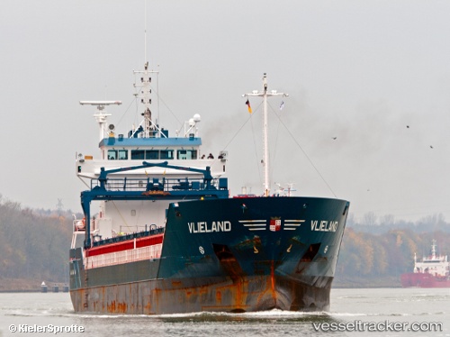
 Vlieland
Current Status
Where is the vessel?
Vlieland is currently in Near Domburg, based on AIS data received less than 1h ago.
Latest AIS update:
Current position: 51.64984° N, 3.33970° E (Near Domburg)
Average speed (last 7 days): Loading…
Average speed (last 30 days): Loading…
Vessel profile: Vlieland is a Multi Purpose Carrier with dimensions 111m x 14m.
This page combines live AIS, route history, probable destination signals, nearby traffic, and port activity for practical vessel monitoring.
The current position of vessel Vlieland is 51.64984 lat / 3.33970 lng. Updated: 2026-04-03 20:27:44 UTCNearest reference points:
- Near Hunsdon
- 12 nm NE of Hunsdon
- Near Oost-Souburg
Currently sailing under the flag of Netherlands ![]()
Vlieland built in 2005 year
Deadweight:
6000 tDetails:
Live Vessel Vlieland Analytics (details, animations, etc.)
Recent AIS points (UTC):
2026-04-03 14:15:04 UTC · 51.45770, 3.72419 · SOG 0 kn · COG 239°2026-04-03 16:24:09 UTC · 51.45771, 3.72419 · SOG 0 kn · COG 241°
2026-04-03 17:21:07 UTC · 51.45771, 3.72419 · SOG 0 kn · COG -1°
2026-04-03 20:27:44 UTC · 51.64984, 3.33970 · SOG 8.8 kn · COG 335°