 vesseltracker.com
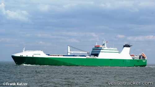
 NEW AMSTERDAM
Current Status
Where is the vessel?
NEW AMSTERDAM is currently in 35 nm NE of Neeltje Jans, based on AIS data received less than 1h ago.
Latest AIS update:
Current position: 53.98842° N, 4.47207° E (35 nm NE of Neeltje Jans)
Average speed (last 7 days): Loading…
Average speed (last 30 days): Loading…
Vessel profile: NEW AMSTERDAM is a Ro-Ro Cargo Ship with dimensions 193m x 26m.
This page combines live AIS, route history, probable destination signals, nearby traffic, and port activity for practical vessel monitoring.
The current position of vessel NEW AMSTERDAM is 53.98842 lat / 4.47207 lng. Updated: 2026-04-18 23:49:43 UTCNearest reference points:
- Near Neeltje Jans
- Near Molengat
- Near de Waal
Currently sailing under the flag of Netherlands ![]()
NEW AMSTERDAM built in 2003 year
Deadweight:
13274 tDetails:
Live Vessel NEW AMSTERDAM Analytics (details, animations, etc.)
Recent AIS points (UTC):
2026-04-18 17:15:15 UTC · 53.66285, 2.57398 · SOG 12 kn · COG -1°2026-04-18 19:20:21 UTC · 53.68774, 3.17115 · SOG 11.5 kn · COG 32°
2026-04-18 21:40:41 UTC · 53.93333, 3.76833 · SOG 12 kn · COG -1°
2026-04-18 23:49:43 UTC · 53.98842, 4.47207 · SOG 11.4 kn · COG 82°