 vesseltracker.com
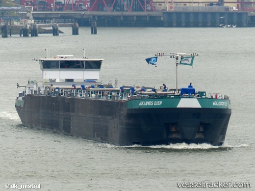
 Hollands Diep
Current Status
Where is the vessel?
Hollands Diep is currently in Near SCHOONHOVEN, based on AIS data received about 1h ago.
Latest AIS update:
Current position: 51.94067° N, 4.86181° E (Near SCHOONHOVEN)
Average speed (last 7 days): Loading…
Average speed (last 30 days): Loading…
Vessel profile: Hollands Diep is a Other Tanker with dimensions 110m x 12m.
This page combines live AIS, route history, probable destination signals, nearby traffic, and port activity for practical vessel monitoring.
The current position of vessel Hollands Diep is 51.94067 lat / 4.86181 lng. Updated: 2026-05-16 05:21:38 UTCNearest reference points:
- Near SCHOONHOVEN
- Near Groot-Ammers
- Near WERKENDAM
Currently sailing under the flag of Netherlands ![]()
Details:
Live Vessel Hollands Diep Analytics (details, animations, etc.)
Recent AIS points (UTC):
2026-05-16 01:45:08 UTC · 52.00763, 5.10851 · SOG 0 kn · COG -1°2026-05-16 03:21:04 UTC · 52.00763, 5.10851 · SOG 0 kn · COG -1°
2026-05-16 04:03:05 UTC · 52.00763, 5.10851 · SOG 0 kn · COG -1°
2026-05-16 05:21:38 UTC · 51.94067, 4.86181 · SOG 10.2 kn · COG -1°