 vesseltracker.com
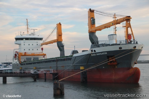
 Trade Navigator
Current Status
Where is the vessel?
Trade Navigator is currently in Near Liverpool, based on AIS data received less than 1h ago.
Latest AIS update:
Current position: 53.43517° N, 3.00075° W (Near Liverpool)
Average speed (last 7 days): Loading…
Average speed (last 30 days): Loading…
Vessel profile: Trade Navigator is a General Cargo Ship with dimensions 118m x 16m.
This page combines live AIS, route history, probable destination signals, nearby traffic, and port activity for practical vessel monitoring.
The current position of vessel Trade Navigator is 53.43517 lat / -3.00075 lng. Updated: 2026-04-23 04:02:53 UTCNearest reference points:
- Near BIRKENHEAD
- Near ELLESMERE
- Near LIVERPOOL ANCH
Currently sailing under the flag of Netherlands ![]()
Details:
Live Vessel Trade Navigator Analytics (details, animations, etc.)
Recent AIS points (UTC):
2026-04-22 22:52:01 UTC · 53.43517, -3.00075 · SOG 0 kn · COG 268°2026-04-22 23:23:02 UTC · 53.43515, -3.00073 · SOG 0 kn · COG 268°
2026-04-23 01:03:22 UTC · 53.43517, -3.00075 · SOG 0 kn · COG 268°
2026-04-23 04:02:53 UTC · 53.43517, -3.00075 · SOG 0 kn · COG 268°