 vesseltracker.com
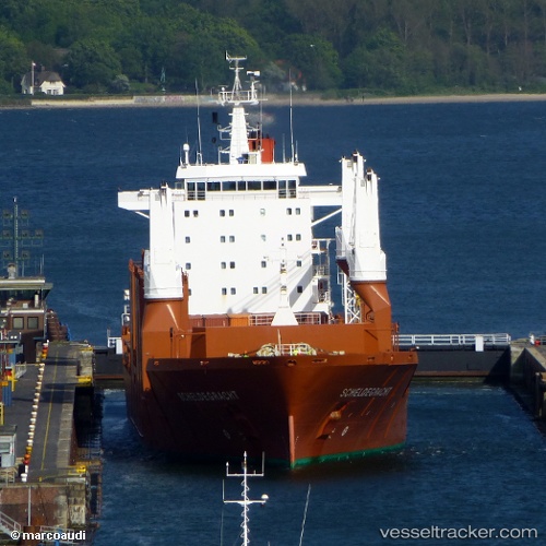
 Scheldegracht
Current Status
Where is the vessel?
Scheldegracht is currently in 27 nm SE of Mcclellanville, based on AIS data received less than 1h ago.
Latest AIS update:
Current position: 32.70987° N, 79.16182° W (27 nm SE of Mcclellanville)
Average speed (last 7 days): Loading…
Average speed (last 30 days): Loading…
Vessel profile: Scheldegracht is a General Cargo Ship with dimensions 172m x 24m.
This page combines live AIS, route history, probable destination signals, nearby traffic, and port activity for practical vessel monitoring.
The current position of vessel Scheldegracht is 32.70987 lat / -79.16182 lng. Updated: 2026-04-30 04:19:08 UTCNearest reference points:
- Near Charleston
- 33 nm S of Kiawah Island
- Near North Myrtle Beach
Currently sailing under the flag of Netherlands ![]()
Scheldegracht built in 2000 year
Deadweight:
21250 tDetails:
Live Vessel Scheldegracht Analytics (details, animations, etc.)
Recent AIS points (UTC):
2026-04-30 01:45:17 UTC · 32.56637, -79.55303 · SOG 9.1 kn · COG 136°2026-04-30 02:09:02 UTC · 32.53860, -79.49372 · SOG 9.3 kn · COG 81°
2026-04-30 03:25:27 UTC · 32.62249, -79.28711 · SOG 9.3 kn · COG 49°
2026-04-30 04:19:08 UTC · 32.70987, -79.16182 · SOG 9 kn · COG 48°