 vesseltracker.com
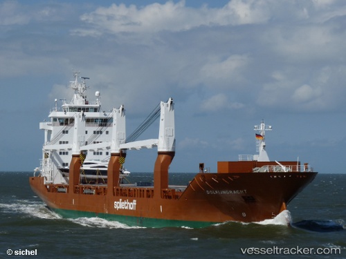
 Dolfijngracht
Current Status
Where is the vessel?
Dolfijngracht is currently in 84 nm S of Fluminense FPSO, based on AIS data received less than 1h ago.
Latest AIS update:
Current position: 24.02333° S, 40.67833° W (84 nm S of Fluminense FPSO)
Average speed (last 7 days): Loading…
Average speed (last 30 days): Loading…
Vessel profile: Dolfijngracht is a General Cargo Ship with dimensions 157m x 23m.
This page combines live AIS, route history, probable destination signals, nearby traffic, and port activity for practical vessel monitoring.
The current position of vessel Dolfijngracht is -24.02333 lat / -40.67833 lng. Updated: 2026-05-15 16:14:48 UTCNearest reference points:
- 47 nm E of Arraial do Cabo
- Near Fluminense FPSO
- 69 nm NE of Cidade de Angra dos Reis FPSO
Currently sailing under the flag of Netherlands ![]()
Dolfijngracht built in 2009 year
Deadweight:
17967 tDetails:
Live Vessel Dolfijngracht Analytics (details, animations, etc.)
Recent AIS points (UTC):
2026-05-15 13:17:50 UTC · -23.70333, -40.26667 · SOG 2 kn · COG -1°2026-05-15 13:41:52 UTC · -23.71167, -40.27667 · SOG 1 kn · COG -1°
2026-05-15 16:09:19 UTC · -24.01016, -40.66475 · SOG 12.4 kn · COG 224°
2026-05-15 16:14:48 UTC · -24.02333, -40.67833 · SOG 13 kn · COG -1°