 vesseltracker.com
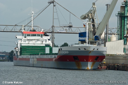
 Flevoborg
Current Status
Where is the vessel?
Flevoborg is currently in 41 nm W of Villy-le-Moutier, based on AIS data received less than 1h ago.
Latest AIS update:
Current position: 47.14154° N, 5.97102° W (41 nm W of Villy-le-Moutier)
Average speed (last 7 days): Loading…
Average speed (last 30 days): Loading…
Vessel profile: Flevoborg is a General Cargo Ship with dimensions 155m x 16m.
This page combines live AIS, route history, probable destination signals, nearby traffic, and port activity for practical vessel monitoring.
The current position of vessel Flevoborg is 47.14154 lat / -5.97102 lng. Updated: 2026-04-16 11:53:56 UTCNearest reference points:
- 46 nm W of SEIN
- 14 nm W of Villy-le-Moutier
- 60 nm SE of San Clodio
Currently sailing under the flag of Netherlands ![]()
Flevoborg built in 2009 year
Deadweight:
14595 tDetails:
Live Vessel Flevoborg Analytics (details, animations, etc.)
Recent AIS points (UTC):
2026-04-16 05:05:25 UTC · 46.21833, -5.58833 · SOG 10 kn · COG -1°2026-04-16 08:14:46 UTC · 46.62550, -5.62250 · SOG 9.1 kn · COG -1°
2026-04-16 09:47:24 UTC · 46.83833, -5.76333 · SOG 9 kn · COG -1°
2026-04-16 11:53:56 UTC · 47.14154, -5.97102 · SOG 10.5 kn · COG 336°