 vesseltracker.com
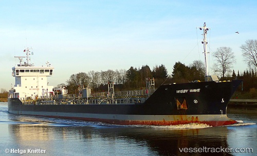
 WISBY WAVE
Current Status
Where is the vessel?
WISBY WAVE is currently in Near Little Thurrock, based on AIS data received less than 1h ago.
Latest AIS update:
Current position: 51.47163° N, 0.30538° E (Near Little Thurrock)
Average speed (last 7 days): Loading…
Average speed (last 30 days): Loading…
Vessel profile: WISBY WAVE is a Oil/Chemical Tanker with dimensions m x m.
This page combines live AIS, route history, probable destination signals, nearby traffic, and port activity for practical vessel monitoring.
The current position of vessel WISBY WAVE is 51.47163 lat / 0.30538 lng. Updated: 2026-05-15 23:39:25 UTCNearest reference points:
- Near Gravesend
- Near GILLINGHAM
- Near Blackheath/London
Currently sailing under the flag of Netherlands ![]()
Details:
Live Vessel WISBY WAVE Analytics (details, animations, etc.)
Recent AIS points (UTC):
2026-05-15 19:51:25 UTC · 51.47163, 0.30538 · SOG 0 kn · COG 83°2026-05-15 21:27:25 UTC · 51.47163, 0.30538 · SOG 0 kn · COG 84°
2026-05-15 22:09:25 UTC · 51.47163, 0.30538 · SOG 0 kn · COG 85°
2026-05-15 23:39:25 UTC · 51.47163, 0.30538 · SOG 0 kn · COG 84°