 vesseltracker.com
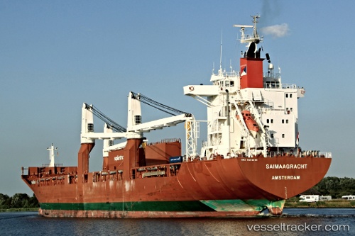
Saimaagracht
Current StatusWhere is the vessel?
Saimaagracht is currently in Near South Baltimore, based on AIS data received about 1h ago.
Latest AIS update:
Current position: 39.26148° N, 76.59114° W (Near South Baltimore)
Average speed (last 7 days): Loading…
Average speed (last 30 days): Loading…
Vessel profile: Saimaagracht is a Multi Purpose Carrier with dimensions 26m x 185m.
This page combines live AIS, route history, probable destination signals, nearby traffic, and port activity for practical vessel monitoring.
The current position of vessel Saimaagracht is 39.26148 lat / -76.59114 lng. Updated: 2026-05-14 00:20:51 UTCNearest reference points:
- Near South Baltimore
- Near Baltimore
- Near Curtis Bay, Baltimore
Details:
Live Vessel Saimaagracht Analytics (details, animations, etc.)
Recent AIS points (UTC):
2026-05-13 19:44:07 UTC · 39.26147, -76.59118 · SOG 0 kn · COG 295°2026-05-13 21:38:08 UTC · 39.26147, -76.59117 · SOG 0 kn · COG 295°
2026-05-13 23:02:07 UTC · 39.26143, -76.59117 · SOG 0 kn · COG 295°
2026-05-14 00:20:51 UTC · 39.26148, -76.59114 · SOG 0 kn · COG 295°