 vesseltracker.com
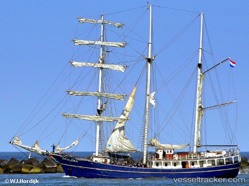
 Thalassa
Current Status
Where is the vessel?
Thalassa is currently in 100 nm E of Tortella, based on AIS data received about 1h ago.
Latest AIS update:
Current position: 42.97500° N, 24.37667° W (100 nm E of Tortella)
Average speed (last 7 days): Loading…
Average speed (last 30 days): Loading…
Vessel profile: Thalassa is a Cruise Ship with dimensions 45m x 8m.
This page combines live AIS, route history, probable destination signals, nearby traffic, and port activity for practical vessel monitoring.
The current position of vessel Thalassa is 42.97500 lat / -24.37667 lng. Updated: 2026-04-03 01:37:43 UTCCurrently sailing under the flag of Netherlands ![]()
Thalassa built in 1980 year
Details:
Live Vessel Thalassa Analytics (details, animations, etc.)
Recent AIS points (UTC):
2026-04-02 20:11:29 UTC · 43.04157, -25.07903 · SOG 5.2 kn · COG 93°2026-04-02 21:31:41 UTC · 43.02333, -24.91167 · SOG 4 kn · COG -1°
2026-04-02 23:34:42 UTC · 42.99667, -24.64500 · SOG 5 kn · COG -1°
2026-04-03 01:37:43 UTC · 42.97500, -24.37667 · SOG 5 kn · COG -1°