 vesseltracker.com
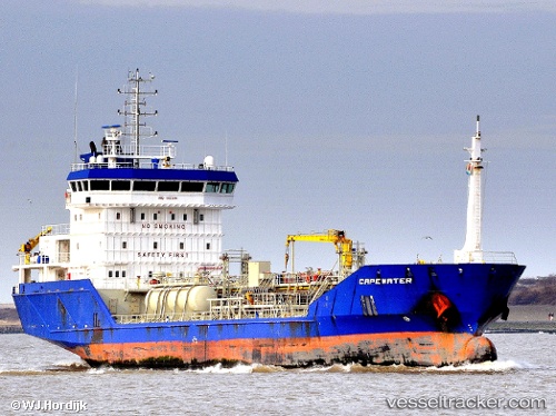
 Capewater
Current Status
Where is the vessel?
Capewater is currently in Near Gonfreville-l'Orcher, based on AIS data received less than 1h ago.
Latest AIS update:
Current position: 49.47147° N, 0.23657° E (Near Gonfreville-l'Orcher)
Average speed (last 7 days): Loading…
Average speed (last 30 days): Loading…
Vessel profile: Capewater is a Chemical Oil Products Tanker with dimensions 100m x 16m.
This page combines live AIS, route history, probable destination signals, nearby traffic, and port activity for practical vessel monitoring.
The current position of vessel Capewater is 49.47147 lat / 0.23657 lng. Updated: 2026-05-15 16:38:20 UTCNearest reference points:
- Near Le Havre
- Near TROUVILLE-SUR-MER
- Near Caen
Currently sailing under the flag of Netherlands ![]()
Capewater built in 2009 year
Deadweight:
5180 tDetails:
Live Vessel Capewater Analytics (details, animations, etc.)
Recent AIS points (UTC):
2026-05-15 13:08:20 UTC · 49.47147, 0.23663 · SOG 0 kn · COG 101°2026-05-15 13:29:14 UTC · 49.47144, 0.23655 · SOG 0 kn · COG 101°
2026-05-15 15:35:19 UTC · 49.47147, 0.23657 · SOG 0 kn · COG 103°
2026-05-15 16:38:20 UTC · 49.47147, 0.23657 · SOG 0 kn · COG 100°