 vesseltracker.com
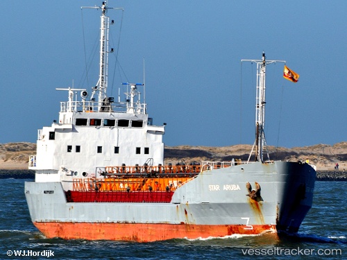
 Star Aruba
Current Status
Where is the vessel?
Star Aruba is currently in Near Port-Grimaud, based on AIS data received less than 1h ago.
Latest AIS update:
Current position: 43.26475° N, 6.58856° E (Near Port-Grimaud)
Average speed (last 7 days): Loading…
Average speed (last 30 days): Loading…
Vessel profile: Star Aruba is a Edible Oil Tanker with dimensions 71m x 10m.
This page combines live AIS, route history, probable destination signals, nearby traffic, and port activity for practical vessel monitoring.
The current position of vessel Star Aruba is 43.26475 lat / 6.58856 lng. Updated: 2026-05-14 11:35:43 UTCNearest reference points:
- Near Port-Grimaud
- Near Saint-Tropez
- Near Sainte-Maxime
Currently sailing under the flag of Netherlands ![]()
Star Aruba built in 1972 year
Deadweight:
1515 tDetails:
Live Vessel Star Aruba Analytics (details, animations, etc.)
Recent AIS points (UTC):
2026-05-14 08:23:42 UTC · 43.26478, 6.58852 · SOG 0 kn · COG 199°2026-05-14 10:11:42 UTC · 43.26478, 6.58851 · SOG 0 kn · COG 200°
2026-05-14 10:38:34 UTC · 43.26477, 6.58853 · SOG 0 kn · COG 200°
2026-05-14 11:35:43 UTC · 43.26475, 6.58856 · SOG 0 kn · COG 199°