 vesseltracker.com
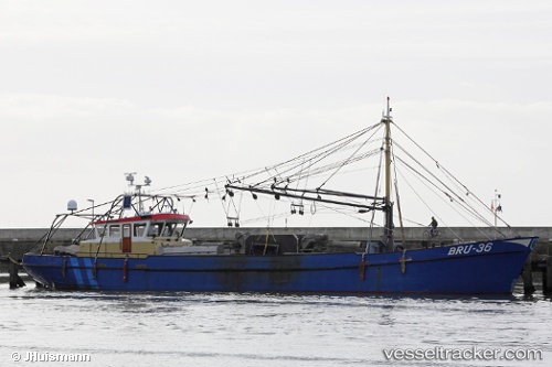
 Bru 12 Wolfert.frank
Current Status
Where is the vessel?
Bru 12 Wolfert.frank is currently in Near DEN OEVER, based on AIS data received less than 1h ago.
Latest AIS update:
Current position: 52.94010° N, 5.03151° E (Near DEN OEVER)
Average speed (last 7 days): Loading…
Average speed (last 30 days): Loading…
Vessel profile: Bru 12 Wolfert.frank is a Fishing Vessel with dimensions 36m x 7m.
This page combines live AIS, route history, probable destination signals, nearby traffic, and port activity for practical vessel monitoring.
The current position of vessel Bru 12 Wolfert.frank is 52.94010 lat / 5.03151 lng. Updated: 2026-05-15 01:15:51 UTCNearest reference points:
- Near DEN OEVER
- Near MARINA DEN OEVER
- Near OUDESCHILD
Currently sailing under the flag of Netherlands ![]()
Details:
Live Vessel Bru 12 Wolfert.frank Analytics (details, animations, etc.)
Recent AIS points (UTC):
2026-05-14 22:01:10 UTC · 52.94011, 5.03151 · SOG 0 kn · COG 43°2026-05-14 22:37:30 UTC · 52.94012, 5.03153 · SOG 0 kn · COG 43°
2026-05-14 23:58:51 UTC · 52.94009, 5.03150 · SOG 0.1 kn · COG 43°
2026-05-15 01:15:51 UTC · 52.94010, 5.03151 · SOG 0 kn · COG 42°