 vesseltracker.com
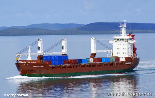
 FLORETGRACHT
Current Status
Where is the vessel?
FLORETGRACHT is currently in 20 nm SE of Ardmore, based on AIS data received less than 1h ago.
Latest AIS update:
Current position: 51.69752° N, 7.35692° W (20 nm SE of Ardmore)
Average speed (last 7 days): Loading…
Average speed (last 30 days): Loading…
Vessel profile: FLORETGRACHT is a General Cargo Ship with dimensions m x m.
This page combines live AIS, route history, probable destination signals, nearby traffic, and port activity for practical vessel monitoring.
The current position of vessel FLORETGRACHT is 51.69752 lat / -7.35692 lng. Updated: 2026-05-16 15:41:56 UTCNearest reference points:
- Near HELVICK
- 45 nm SE of Covent Garden
- Near Cobn
Currently sailing under the flag of Netherlands ![]()
FLORETGRACHT built in 2012 year
Deadweight:
12067 tDetails:
Live Vessel FLORETGRACHT Analytics (details, animations, etc.)
Recent AIS points (UTC):
2026-05-16 12:12:46 UTC · 52.10587, -6.24559 · SOG 15.4 kn · COG 237°2026-05-16 13:12:16 UTC · 51.98279, -6.59396 · SOG 14.6 kn · COG 235°
2026-05-16 13:30:03 UTC · 51.94488, -6.69215 · SOG 14.2 kn · COG 235°
2026-05-16 15:41:56 UTC · 51.69752, -7.35692 · SOG 12.5 kn · COG 240°