 vesseltracker.com
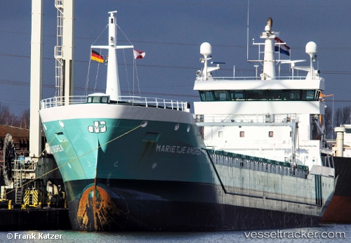
 Marietje Andrea
Current Status
Where is the vessel?
Marietje Andrea is currently in Near Waterport, based on AIS data received less than 1h ago.
Latest AIS update:
Current position: 36.13977° N, 5.37155° W (Near Waterport)
Average speed (last 7 days): Loading…
Average speed (last 30 days): Loading…
Vessel profile: Marietje Andrea is a General Cargo Ship with dimensions 126m x 15m.
This page combines live AIS, route history, probable destination signals, nearby traffic, and port activity for practical vessel monitoring.
The current position of vessel Marietje Andrea is 36.13977 lat / -5.37155 lng. Updated: 2026-05-14 18:07:07 UTCNearest reference points:
- Near Waterport
- Near La Línea de la Concepción
- Near Palmones
Currently sailing under the flag of Netherlands ![]()
Marietje Andrea built in 2009 year
Deadweight:
8334 tDetails:
Live Vessel Marietje Andrea Analytics (details, animations, etc.)
Recent AIS points (UTC):
2026-05-14 14:06:57 UTC · 36.10683, -5.36387 · SOG 5.9 kn · COG 321°2026-05-14 15:40:09 UTC · 36.14313, -5.37126 · SOG 0 kn · COG 219°
2026-05-14 16:34:10 UTC · 36.14121, -5.37099 · SOG 0 kn · COG 297°
2026-05-14 18:07:07 UTC · 36.13977, -5.37155 · SOG 0.2 kn · COG 330°