 vesseltracker.com
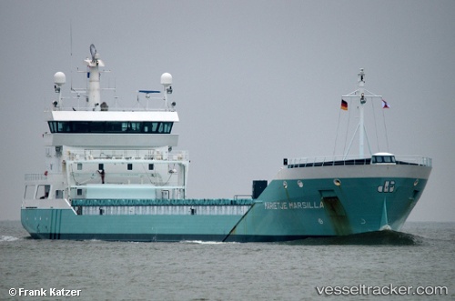
 Marietje Marsilla
Current Status
Where is the vessel?
Marietje Marsilla is currently in 27 nm SW of Glesvær, based on AIS data received about 1h ago.
Latest AIS update:
Current position: 60.01647° N, 4.22363° E (27 nm SW of Glesvær)
Average speed (last 7 days): Loading…
Average speed (last 30 days): Loading…
Vessel profile: Marietje Marsilla is a General Cargo Ship with dimensions 126m x 126m.
This page combines live AIS, route history, probable destination signals, nearby traffic, and port activity for practical vessel monitoring.
The current position of vessel Marietje Marsilla is 60.01647 lat / 4.22363 lng. Updated: 2026-04-19 01:23:14 UTCNearest reference points:
- Near Glesvær
- Near TORANGSVAG
- Near Hakonsvern
Currently sailing under the flag of Netherlands ![]()
Marietje Marsilla built in 2010 year
Deadweight:
8334 tDetails:
Live Vessel Marietje Marsilla Analytics (details, animations, etc.)
Recent AIS points (UTC):
2026-04-18 19:21:58 UTC · 59.10674, 4.21407 · SOG 9.8 kn · COG 0°2026-04-18 21:41:46 UTC · 59.48646, 4.21434 · SOG 9 kn · COG 359°
2026-04-18 23:50:37 UTC · 59.79667, 4.22500 · SOG 8 kn · COG -1°
2026-04-19 01:23:14 UTC · 60.01647, 4.22363 · SOG 9 kn · COG 1°