 vesseltracker.com
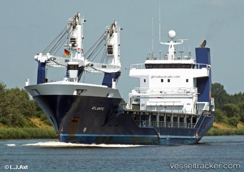
 Atlantic
Current Status
Where is the vessel?
Atlantic is currently in 19 nm SE of Zamoranos, based on AIS data received about 1h ago.
Latest AIS update:
Current position: 37.26775° N, 4.40627° E (19 nm SE of Zamoranos)
Average speed (last 7 days): Loading…
Average speed (last 30 days): Loading…
Vessel profile: Atlantic is a General Cargo Ship with dimensions 105m x 16m.
This page combines live AIS, route history, probable destination signals, nearby traffic, and port activity for practical vessel monitoring.
The current position of vessel Atlantic is 37.26775 lat / 4.40627 lng. Updated: 2026-05-14 11:39:37 UTCNearest reference points:
- Near Zamoranos
- Near Bejaia
- Near Carmona
Currently sailing under the flag of Netherlands ![]()
Atlantic built in 2011 year
Deadweight:
3750 tDetails:
Live Vessel Atlantic Analytics (details, animations, etc.)
Recent AIS points (UTC):
2026-05-14 08:24:20 UTC · 37.13472, 3.32058 · SOG 15.9 kn · COG 86°2026-05-14 10:12:37 UTC · 37.20252, 3.92057 · SOG 16.1 kn · COG 78°
2026-05-14 10:41:56 UTC · 37.22355, 4.08207 · SOG 16.4 kn · COG 78°
2026-05-14 11:39:37 UTC · 37.26775, 4.40627 · SOG 16 kn · COG 78°