 vesseltracker.com
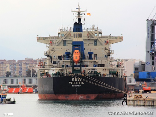
 Kea
Kea
Current Status
Where is the vessel?
Kea is currently in 72 nm N of KENDARI, based on AIS data received about 2h ago.
Latest AIS update:
Current position: 2.82243° S, 122.24038° E (72 nm N of KENDARI)
Average speed (last 7 days): Loading…
Average speed (last 30 days): Loading…
Vessel profile: Kea is a Bulk Carrier with dimensions 225m x 225m.
This page combines live AIS, route history, probable destination signals, nearby traffic, and port activity for practical vessel monitoring.
The current position of vessel Kea is -2.82243 lat / 122.24038 lng. Updated: 2026-04-27 15:33:25 UTCNearest reference points:
- 45 nm N of KENDARI
- 11 nm NW of KENDARI
- 22 nm S of Tangkiang
Currently sailing under the flag of Malta ![]()
Kea built in 2010 year
Deadweight:
75633 tDetails:
Live Vessel Kea Analytics (details, animations, etc.)
Recent AIS points (UTC):
2026-04-27 11:23:11 UTC · -2.81879, 122.24406 · SOG 0.6 kn · COG 213°2026-04-27 14:13:21 UTC · -2.82167, 122.24167 · SOG 0 kn · COG -1°
2026-04-27 15:33:25 UTC · -2.82243, 122.24038 · SOG 0.1 kn · COG 41°
2026-04-27 15:33:25 UTC · -2.82243, 122.24038 · SOG 0.1 kn · COG 41°