 vesseltracker.com
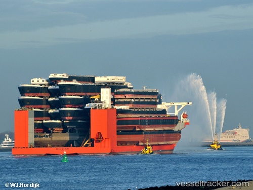
 BLUE MARLIN
Current Status
Where is the vessel?
BLUE MARLIN is currently in 189 nm SW of Luderitz Bay, based on AIS data received less than 1h ago.
Latest AIS update:
Current position: 28.57368° S, 12.34314° E (189 nm SW of Luderitz Bay)
Average speed (last 7 days): Loading…
Average speed (last 30 days): Loading…
Vessel profile: BLUE MARLIN is a Heavy Load Carrier with dimensions 225m x 63m.
This page combines live AIS, route history, probable destination signals, nearby traffic, and port activity for practical vessel monitoring.
The current position of vessel BLUE MARLIN is -28.57368 lat / 12.34314 lng. Updated: 2026-04-28 08:01:41 UTCNearest reference points:
- 312 nm SW of Luderitz Bay
- 161 nm W of Koiingnaas
- 154 nm W of Koiingnaas
Currently sailing under the flag of Malta ![]()
BLUE MARLIN built in 2000 year
Deadweight:
76061 tDetails:
Live Vessel BLUE MARLIN Analytics (details, animations, etc.)
Recent AIS points (UTC):
2026-04-28 04:01:21 UTC · -28.91203, 13.09705 · SOG 10.6 kn · COG 301°2026-04-28 04:47:16 UTC · -28.85070, 12.96233 · SOG 10.6 kn · COG 296°
2026-04-28 06:04:41 UTC · -28.73973, 12.72105 · SOG 11 kn · COG 295°
2026-04-28 08:01:41 UTC · -28.57368, 12.34314 · SOG 11.4 kn · COG 299°