 vesseltracker.com
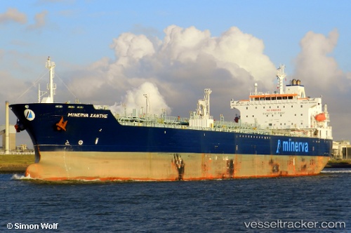
 Minerva Xanthe
Current Status
Where is the vessel?
Minerva Xanthe is currently in 16 nm W of Utiel, based on AIS data received about 1h ago.
Latest AIS update:
Current position: 39.58771° N, 11.51625° W (16 nm W of Utiel)
Average speed (last 7 days): Loading…
Average speed (last 30 days): Loading…
Vessel profile: Minerva Xanthe is a Crude Oil Tanker with dimensions 183m x 32m.
This page combines live AIS, route history, probable destination signals, nearby traffic, and port activity for practical vessel monitoring.
The current position of vessel Minerva Xanthe is 39.58771 lat / -11.51625 lng. Updated: 2026-05-14 11:35:23 UTCNearest reference points:
- 43 nm NW of Utiel
- 92 nm SW of Utiel
- 94 nm W of Los Ramos
Currently sailing under the flag of Malta ![]()
Minerva Xanthe built in 2006 year
Deadweight:
50922 tDetails:
Live Vessel Minerva Xanthe Analytics (details, animations, etc.)
Recent AIS points (UTC):
2026-05-14 07:22:02 UTC · 38.90121, -11.49631 · SOG 9.9 kn · COG 359°2026-05-14 09:42:21 UTC · 39.28581, -11.50586 · SOG 9.8 kn · COG 0°
2026-05-14 10:39:22 UTC · 39.43738, -11.51078 · SOG 9.4 kn · COG 2°
2026-05-14 11:35:23 UTC · 39.58771, -11.51625 · SOG 9.6 kn · COG 5°