 vesseltracker.com
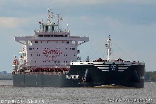
 Flag Mette
Current Status
Where is the vessel?
Flag Mette is currently in 25 nm S of Worth Matravers, based on AIS data received about 1h ago.
Latest AIS update:
Current position: 50.18272° N, 1.85739° W (25 nm S of Worth Matravers)
Average speed (last 7 days): Loading…
Average speed (last 30 days): Loading…
Vessel profile: Flag Mette is a Bulk Carrier with dimensions 229m x 32m.
This page combines live AIS, route history, probable destination signals, nearby traffic, and port activity for practical vessel monitoring.
The current position of vessel Flag Mette is 50.18272 lat / -1.85739 lng. Updated: 2026-04-08 14:14:34 UTCNearest reference points:
- 22 nm S of Holbury
- 11 nm SW of Holbury
- 20 nm S of Holbury
Currently sailing under the flag of Malta ![]()
Details:
Live Vessel Flag Mette Analytics (details, animations, etc.)
Recent AIS points (UTC):
2026-04-08 08:22:36 UTC · 50.45012, -0.35700 · SOG 12.2 kn · COG 255°2026-04-08 10:04:46 UTC · 50.36438, -0.83778 · SOG 10.3 kn · COG 254°
2026-04-08 11:48:46 UTC · 50.29002, -1.24969 · SOG 9.1 kn · COG 257°
2026-04-08 14:14:34 UTC · 50.18272, -1.85739 · SOG 11.1 kn · COG 254°