 vesseltracker.com
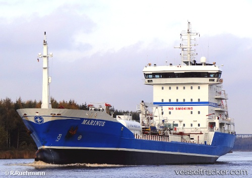
 ECOSTAR
Current Status
Where is the vessel?
ECOSTAR is currently in 31 nm S of Chilches, based on AIS data received less than 1h ago.
Latest AIS update:
Current position: 36.21264° N, 4.08753° W (31 nm S of Chilches)
Average speed (last 7 days): Loading…
Average speed (last 30 days): Loading…
Vessel profile: ECOSTAR is a Chemical Tanker with dimensions m x m.
This page combines live AIS, route history, probable destination signals, nearby traffic, and port activity for practical vessel monitoring.
The current position of vessel ECOSTAR is 36.21264 lat / -4.08753 lng. Updated: 2026-05-14 18:09:22 UTCNearest reference points:
- 31 nm SE of Fuengirola
- 24 nm S of El Morche
- Near VELEZ
Currently sailing under the flag of Malta ![]()
Details:
Live Vessel ECOSTAR Analytics (details, animations, etc.)
Recent AIS points (UTC):
2026-05-14 14:06:53 UTC · 36.26656, -3.52420 · SOG 8.9 kn · COG 262°2026-05-14 15:37:00 UTC · 36.24928, -3.77845 · SOG 8.2 kn · COG 266°
2026-05-14 16:34:53 UTC · 36.23352, -3.92284 · SOG 5.3 kn · COG 264°
2026-05-14 18:09:22 UTC · 36.21264, -4.08753 · SOG 5.8 kn · COG 270°