 vesseltracker.com
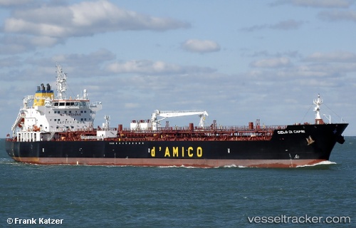
 Cielo Di Capri
Current Status
Where is the vessel?
Cielo Di Capri is currently in 54 nm NE of Dorst, based on AIS data received less than 1h ago.
Latest AIS update:
Current position: 42.12877° N, 5.80934° E (54 nm NE of Dorst)
Average speed (last 7 days): Loading…
Average speed (last 30 days): Loading…
Vessel profile: Cielo Di Capri is a Oil Products Tanker with dimensions 184m x 27m.
This page combines live AIS, route history, probable destination signals, nearby traffic, and port activity for practical vessel monitoring.
The current position of vessel Cielo Di Capri is 42.12877 lat / 5.80934 lng. Updated: 2026-04-24 16:06:11 UTCNearest reference points:
- 54 nm W of Larouco
- 23 nm SW of Toulon
- Near Six-Fours-les-Plages
Currently sailing under the flag of Malta ![]()
Details:
Live Vessel Cielo Di Capri Analytics (details, animations, etc.)
Recent AIS points (UTC):
2026-04-24 13:04:11 UTC · 41.67620, 6.12444 · SOG 12.9 kn · COG 333°2026-04-24 13:59:55 UTC · 41.77558, 6.05275 · SOG 12.7 kn · COG 332°
2026-04-24 16:06:11 UTC · 42.12877, 5.80934 · SOG 12.6 kn · COG 330°
2026-04-24 16:06:11 UTC · 42.12877, 5.80934 · SOG 12.6 kn · COG 330°