 vesseltracker.com
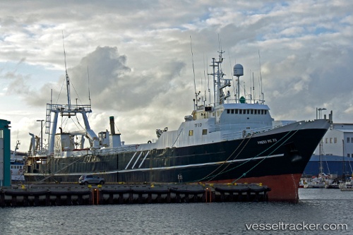
Blaengur
Current StatusWhere is the vessel?
Blaengur is currently in 27 nm S of OLAFSVIK, based on AIS data received about 1h ago.
Latest AIS update:
Current position: 64.45496° N, 23.56153° W (27 nm S of OLAFSVIK)
Average speed (last 7 days): Loading…
Average speed (last 30 days): Loading…
Vessel profile: Blaengur is a Fishing Vessel with dimensions 12m x 79m.
This page combines live AIS, route history, probable destination signals, nearby traffic, and port activity for practical vessel monitoring.
The current position of vessel Blaengur is 64.45496 lat / -23.56153 lng. Updated: 2026-05-14 21:42:03 UTCNearest reference points:
- Near RIF
- Near SANDGERDI
- Near FLATEYRI
Details:
Live Vessel Blaengur Analytics (details, animations, etc.)
Recent AIS points (UTC):
2026-05-14 20:00:26 UTC · 64.24613, -22.79681 · SOG 14.1 kn · COG 302°2026-05-14 20:00:26 UTC · 64.24613, -22.79681 · SOG 14.1 kn · COG 302°
2026-05-14 21:42:03 UTC · 64.45496, -23.56153 · SOG 14.1 kn · COG 300°
2026-05-14 21:42:03 UTC · 64.45496, -23.56153 · SOG 14.1 kn · COG 300°