 vesseltracker.com
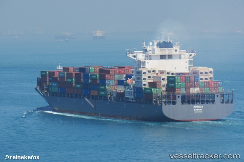
Emirates Asante
Current StatusWhere is the vessel?
Emirates Asante is currently in 40 nm S of Tanjung Pandan, based on AIS data received about 4h ago.
Latest AIS update:
Current position: 3.36993° S, 107.40161° E (40 nm S of Tanjung Pandan)
Average speed (last 7 days): Loading…
Average speed (last 30 days): Loading…
Vessel profile: Emirates Asante is a Container Ship with dimensions 37m x 255m.
This page combines live AIS, route history, probable destination signals, nearby traffic, and port activity for practical vessel monitoring.
The current position of vessel Emirates Asante is -3.36993 lat / 107.40161 lng. Updated: 2026-05-14 23:46:12 UTCNearest reference points:
- 46 nm NW of Tanjung Pandan
- 96 nm E of Widuri
- 53 nm NE of Tanjung Pandan
Details:
Live Vessel Emirates Asante Analytics (details, animations, etc.)
Recent AIS points (UTC):
2026-05-14 21:49:00 UTC · -2.83752, 107.23447 · SOG 17.5 kn · COG 156°2026-05-14 22:20:15 UTC · -2.97815, 107.29461 · SOG 17.1 kn · COG 160°
2026-05-14 23:43:55 UTC · -3.36031, 107.39531 · SOG 17.9 kn · COG 146°
2026-05-14 23:46:12 UTC · -3.36993, 107.40161 · SOG 17.9 kn · COG 146°