 vesseltracker.com
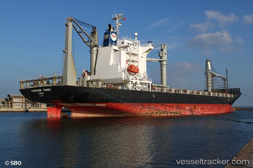
 FERDINANDA S
Current Status
Where is the vessel?
FERDINANDA S is currently in Near Bissau, based on AIS data received less than 1h ago.
Latest AIS update:
Current position: 11.81475° N, 15.57275° W (Near Bissau)
Average speed (last 7 days): Loading…
Average speed (last 30 days): Loading…
Vessel profile: FERDINANDA S is a Container Ship with dimensions 28m x 172m.
This page combines live AIS, route history, probable destination signals, nearby traffic, and port activity for practical vessel monitoring.
The current position of vessel FERDINANDA S is 11.81475 lat / -15.57275 lng. Updated: 2026-05-15 05:59:37 UTCNearest reference points:
- Near San Francisco Libre
- Near Dougoula
- Near Port de Boké
Currently sailing under the flag of Portugal (MAR) ![]()
FERDINANDA S built in 2008 year
Deadweight:
21464 tDetails:
Live Vessel FERDINANDA S Analytics (details, animations, etc.)
Recent AIS points (UTC):
2026-05-15 01:08:30 UTC · 11.81516, -15.57426 · SOG 0 kn · COG 33°2026-05-15 03:47:34 UTC · 11.81424, -15.57431 · SOG 0.3 kn · COG 43°
2026-05-15 04:59:38 UTC · 11.81486, -15.57444 · SOG 0 kn · COG 38°
2026-05-15 05:59:37 UTC · 11.81475, -15.57275 · SOG 0.6 kn · COG 337°