 vesseltracker.com
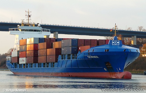
 Meandi
Current Status
Where is the vessel?
Meandi is currently in 38 nm SW of CHIPIONA, based on AIS data received less than 1h ago.
Latest AIS update:
Current position: 36.45353° N, 7.11798° W (38 nm SW of CHIPIONA)
Average speed (last 7 days): Loading…
Average speed (last 30 days): Loading…
Vessel profile: Meandi is a Container Ship with dimensions 141m x 22m.
This page combines live AIS, route history, probable destination signals, nearby traffic, and port activity for practical vessel monitoring.
The current position of vessel Meandi is 36.45353 lat / -7.11798 lng. Updated: 2026-05-14 18:09:22 UTCNearest reference points:
- 45 nm W of Gibraltar
- Near La Antilla
- 42 nm S of Faro
Currently sailing under the flag of Portugal ![]()
Meandi built in 2006 year
Deadweight:
9350 tDetails:
Live Vessel Meandi Analytics (details, animations, etc.)
Recent AIS points (UTC):
2026-05-14 14:06:29 UTC · 35.78667, -7.89500 · SOG 14 kn · COG -1°2026-05-14 15:30:31 UTC · 36.02667, -7.61833 · SOG 14 kn · COG -1°
2026-05-14 16:31:30 UTC · 36.19937, -7.41522 · SOG 14.2 kn · COG 41°
2026-05-14 18:09:22 UTC · 36.45353, -7.11798 · SOG 11.4 kn · COG 40°