 vesseltracker.com
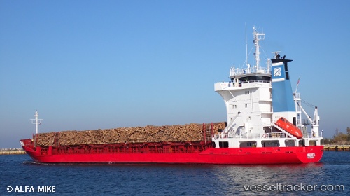
 Merita
Current Status
Where is the vessel?
Merita is currently in 16 nm SE of Studsvik, based on AIS data received about 1h ago.
Latest AIS update:
Current position: 58.59833° N, 17.77167° E (16 nm SE of Studsvik)
Average speed (last 7 days): Loading…
Average speed (last 30 days): Loading…
Vessel profile: Merita is a Multi Purpose Carrier with dimensions 99m x 99m.
This page combines live AIS, route history, probable destination signals, nearby traffic, and port activity for practical vessel monitoring.
The current position of vessel Merita is 58.59833 lat / 17.77167 lng. Updated: 2026-05-15 17:52:01 UTCNearest reference points:
- Near Stora Vika
- Near SODERTALJE
- Near Segeltorp
Currently sailing under the flag of Portugal ![]()
Merita built in 1985 year
Deadweight:
4496 tDetails:
Live Vessel Merita Analytics (details, animations, etc.)
Recent AIS points (UTC):
2026-05-15 13:27:21 UTC · 58.59992, 17.77256 · SOG 0 kn · COG 105°2026-05-15 15:30:22 UTC · 58.59988, 17.77247 · SOG 0 kn · COG 99°
2026-05-15 16:36:23 UTC · 58.59991, 17.77243 · SOG 0 kn · COG 101°
2026-05-15 17:52:01 UTC · 58.59833, 17.77167 · SOG 0 kn · COG -1°