 vesseltracker.com
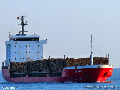
 Beata
Beata
Current Status
Where is the vessel?
Beata is currently in Near Drammen Harbor, based on AIS data received about 1h ago.
Latest AIS update:
Current position: 59.74426° N, 10.25792° E (Near Drammen Harbor)
Average speed (last 7 days): Loading…
Average speed (last 30 days): Loading…
Vessel profile: Beata is a Multi Purpose Carrier with dimensions 107m x 18m.
This page combines live AIS, route history, probable destination signals, nearby traffic, and port activity for practical vessel monitoring.
The current position of vessel Beata is 59.74426 lat / 10.25792 lng. Updated: 2026-04-26 03:20:35 UTCNearest reference points:
- Near Langøya
- Near Billingstad
- Near Slemmestad
Currently sailing under the flag of Portugal ![]()
Beata built in 1994 year
Deadweight:
6918 tDetails:
Live Vessel Beata Analytics (details, animations, etc.)
Recent AIS points (UTC):
2026-04-26 00:05:36 UTC · 59.74427, 10.25796 · SOG 0 kn · COG 334°2026-04-26 01:08:35 UTC · 59.74421, 10.25780 · SOG 0 kn · COG 334°
2026-04-26 01:32:34 UTC · 59.74426, 10.25784 · SOG 0 kn · COG 334°
2026-04-26 03:20:35 UTC · 59.74426, 10.25792 · SOG 0 kn · COG 334°