 vesseltracker.com
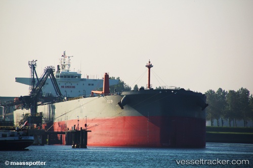
 Nordtulip
Current Status
Where is the vessel?
Nordtulip is currently in 16 nm E of Fenwick Island, based on AIS data received less than 1h ago.
Latest AIS update:
Current position: 38.43383° N, 74.70814° W (16 nm E of Fenwick Island)
Average speed (last 7 days): Loading…
Average speed (last 30 days): Loading…
Vessel profile: Nordtulip is a Crude Oil Tanker with dimensions 229m x 42m.
This page combines live AIS, route history, probable destination signals, nearby traffic, and port activity for practical vessel monitoring.
The current position of vessel Nordtulip is 38.43383 lat / -74.70814 lng. Updated: 2026-05-12 19:40:17 UTCNearest reference points:
- 24 nm E of West Ocean City
- Near Slaughter Beach
- Near Corbin City
Currently sailing under the flag of Portugal ![]()
Nordtulip built in 2013 year
Deadweight:
104280 tDetails:
Live Vessel Nordtulip Analytics (details, animations, etc.)
Recent AIS points (UTC):
2026-05-12 16:23:08 UTC · 38.87796, -75.08880 · SOG 11.3 kn · COG 170°2026-05-12 17:21:57 UTC · 38.72854, -74.98688 · SOG 10.9 kn · COG 135°
2026-05-12 19:16:17 UTC · 38.47819, -74.76183 · SOG 9.3 kn · COG 145°
2026-05-12 19:40:17 UTC · 38.43383, -74.70814 · SOG 9.2 kn · COG 123°