 vesseltracker.com
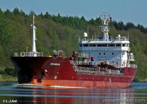
 ORAMALIA
Current Status
Where is the vessel?
ORAMALIA is currently in 12 nm N of ALDERNEY, based on AIS data received about 1h ago.
Latest AIS update:
Current position: 49.92460° N, 2.29026° W (12 nm N of ALDERNEY)
Average speed (last 7 days): Loading…
Average speed (last 30 days): Loading…
Vessel profile: ORAMALIA is a Chemical/Oil Products Tanker with dimensions 103m x 16m.
This page combines live AIS, route history, probable destination signals, nearby traffic, and port activity for practical vessel monitoring.
The current position of vessel ORAMALIA is 49.92460 lat / -2.29026 lng. Updated: 2026-05-14 19:50:07 UTCNearest reference points:
- Near ALDERNEY
- Near SAINT SAMPSON
- Near Saint Sampson
Currently sailing under the flag of Portugal (MAR) ![]()
ORAMALIA built in 2007 year
Deadweight:
6863 tDetails:
Live Vessel ORAMALIA Analytics (details, animations, etc.)
Recent AIS points (UTC):
2026-05-14 16:35:01 UTC · 49.70699, -3.21198 · SOG 11.1 kn · COG 57°2026-05-14 18:10:19 UTC · 49.83621, -2.78929 · SOG 12 kn · COG 79°
2026-05-14 19:09:37 UTC · 49.88829, -2.49100 · SOG 11.9 kn · COG 76°
2026-05-14 19:50:07 UTC · 49.92460, -2.29026 · SOG 11.8 kn · COG 76°