 vesseltracker.com
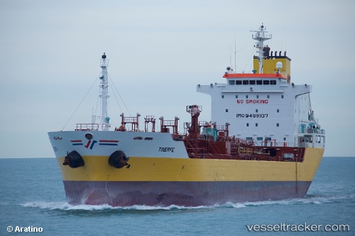
 TINERFE
Current Status
Where is the vessel?
TINERFE is currently in Near CARTEYA GUADARRANQUE, based on AIS data received less than 1h ago.
Latest AIS update:
Current position: 36.17723° N, 5.39935° W (Near CARTEYA GUADARRANQUE)
Average speed (last 7 days): Loading…
Average speed (last 30 days): Loading…
Vessel profile: TINERFE is a Oil/Chemical Tanker with dimensions m x m.
This page combines live AIS, route history, probable destination signals, nearby traffic, and port activity for practical vessel monitoring.
The current position of vessel TINERFE is 36.17723 lat / -5.39935 lng. Updated: 2026-05-15 05:05:24 UTCNearest reference points:
- Near Palmones
- Near La Línea de la Concepción
- Near Waterport
Currently sailing under the flag of Portugal ![]()
Details:
Live Vessel TINERFE Analytics (details, animations, etc.)
Recent AIS points (UTC):
2026-05-14 23:47:22 UTC · 36.17722, -5.39938 · SOG 0 kn · COG 262°2026-05-15 01:14:23 UTC · 36.17725, -5.39935 · SOG 0 kn · COG 262°
2026-05-15 03:47:24 UTC · 36.17723, -5.39936 · SOG 0 kn · COG 262°
2026-05-15 05:05:24 UTC · 36.17723, -5.39935 · SOG 0 kn · COG 262°