 vesseltracker.com
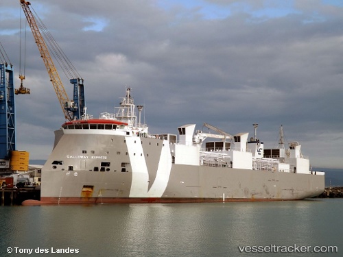
 GALLOWAY EXPRESS
Current Status
Where is the vessel?
GALLOWAY EXPRESS is currently in 90 nm S of PASITO BLANCO, based on AIS data received about 1h ago.
Latest AIS update:
Current position: 26.28167° N, 16.00167° W (90 nm S of PASITO BLANCO)
Average speed (last 7 days): Loading…
Average speed (last 30 days): Loading…
Vessel profile: GALLOWAY EXPRESS is a Livestock Carrier with dimensions m x m.
This page combines live AIS, route history, probable destination signals, nearby traffic, and port activity for practical vessel monitoring.
The current position of vessel GALLOWAY EXPRESS is 26.28167 lat / -16.00167 lng. Updated: 2026-05-14 19:46:41 UTCNearest reference points:
- 33 nm SE of San Agustin
- 22 nm S of San Agustin
- Near San Nicolás
Currently sailing under the flag of Portugal ![]()
Details:
Live Vessel GALLOWAY EXPRESS Analytics (details, animations, etc.)
Recent AIS points (UTC):
2026-05-14 16:25:42 UTC · 27.01167, -15.64833 · SOG 14 kn · COG -1°2026-05-14 18:01:41 UTC · 26.66333, -15.82500 · SOG 14 kn · COG -1°
2026-05-14 19:10:39 UTC · 26.41333, -15.94500 · SOG 13 kn · COG -1°
2026-05-14 19:46:41 UTC · 26.28167, -16.00167 · SOG 13 kn · COG -1°