 vesseltracker.com
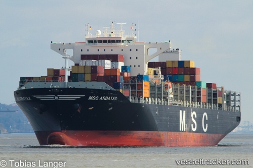
 MSC DAKAR X
Current Status
Where is the vessel?
MSC DAKAR X is currently in 66 nm N of Attu Island, based on AIS data received less than 1h ago.
Latest AIS update:
Current position: 54.03365° N, 173.66814° E (66 nm N of Attu Island)
Average speed (last 7 days): Loading…
Average speed (last 30 days): Loading…
Vessel profile: MSC DAKAR X is a Container Ship with dimensions m x m.
This page combines live AIS, route history, probable destination signals, nearby traffic, and port activity for practical vessel monitoring.
The current position of vessel MSC DAKAR X is 54.03365 lat / 173.66814 lng. Updated: 2026-05-15 01:24:33 UTCNearest reference points:
- 57 nm SW of Zagorow
Currently sailing under the flag of Portugal ![]()
Details:
Live Vessel MSC DAKAR X Analytics (details, animations, etc.)
Recent AIS points (UTC):
2026-05-14 22:10:18 UTC · 54.24355, 175.40096 · SOG 19.2 kn · COG 260°2026-05-14 22:10:18 UTC · 54.24355, 175.40096 · SOG 19.2 kn · COG 260°
2026-05-14 23:20:36 UTC · 54.16694, 174.77232 · SOG 19.2 kn · COG 259°
2026-05-15 01:24:33 UTC · 54.03365, 173.66814 · SOG 19.2 kn · COG 258°