 vesseltracker.com
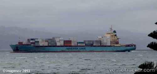
 Sine A
Current Status
Where is the vessel?
Sine A is currently in 73 nm NW of Nouadhibou, based on AIS data received less than 1h ago.
Latest AIS update:
Current position: 21.60667° N, 18.03833° W (73 nm NW of Nouadhibou)
Average speed (last 7 days): Loading…
Average speed (last 30 days): Loading…
Vessel profile: Sine A is a Container Ship with dimensions 222m x 222m.
This page combines live AIS, route history, probable destination signals, nearby traffic, and port activity for practical vessel monitoring.
The current position of vessel Sine A is 21.60667 lat / -18.03833 lng. Updated: 2026-04-09 19:18:14 UTCNearest reference points:
- 41 nm NW of Nouadhibou
- Near Nouadhibou
- Near DAKHLA
Currently sailing under the flag of Malta ![]()
Sine A built in 2008 year
Deadweight:
39426 tDetails:
Live Vessel Sine A Analytics (details, animations, etc.)
Recent AIS points (UTC):
2026-04-09 13:44:48 UTC · 22.67833, -17.80333 · SOG 12 kn · COG -1°2026-04-09 15:29:55 UTC · 22.33667, -17.88500 · SOG 11 kn · COG -1°
2026-04-09 18:12:57 UTC · 21.81390, -17.99312 · SOG 11.7 kn · COG 188°
2026-04-09 19:18:14 UTC · 21.60667, -18.03833 · SOG 11 kn · COG -1°