 vesseltracker.com
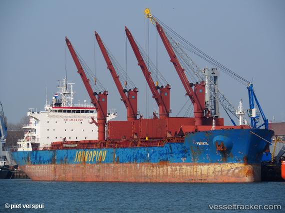
 Peristil
Current Status
Where is the vessel?
Peristil is currently in Near Mombasa, based on AIS data received less than 1h ago.
Latest AIS update:
Current position: 4.05350° S, 39.64733° E (Near Mombasa)
Average speed (last 7 days): Loading…
Average speed (last 30 days): Loading…
Vessel profile: Peristil is a Bulk Carrier with dimensions 190m x 32m.
This page combines live AIS, route history, probable destination signals, nearby traffic, and port activity for practical vessel monitoring.
The current position of vessel Peristil is -4.05350 lat / 39.64733 lng. Updated: 2026-04-24 10:42:36 UTCNearest reference points:
- Near Mombasa
- 11 nm SE of Mombasa
Currently sailing under the flag of Malta ![]()
Details:
Live Vessel Peristil Analytics (details, animations, etc.)
Recent AIS points (UTC):
2026-04-24 07:31:14 UTC · -4.05360, 39.64731 · SOG 0 kn · COG 165°2026-04-24 07:33:54 UTC · -4.05358, 39.64729 · SOG 0 kn · COG 165°
2026-04-24 09:45:27 UTC · -4.05358, 39.64733 · SOG 0 kn · COG 165°
2026-04-24 10:42:36 UTC · -4.05350, 39.64733 · SOG 0.1 kn · COG 165°