 vesseltracker.com
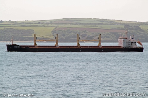
 Red Fin
Current Status
Where is the vessel?
Red Fin is currently in 157 nm SW of Hastings Apt/Freetown, based on AIS data received less than 1h ago.
Latest AIS update:
Current position: 6.43833° N, 14.90667° W (157 nm SW of Hastings Apt/Freetown)
Average speed (last 7 days): Loading…
Average speed (last 30 days): Loading…
Vessel profile: Red Fin is a Bulk Carrier with dimensions 190m x 190m.
This page combines live AIS, route history, probable destination signals, nearby traffic, and port activity for practical vessel monitoring.
The current position of vessel Red Fin is 6.43833 lat / -14.90667 lng. Updated: 2026-05-16 15:40:44 UTCNearest reference points:
- 126 nm SW of YORK
- 79 nm SW of Conakry
- Near NASSIT
Currently sailing under the flag of Malta ![]()
Red Fin built in 2011 year
Deadweight:
56780 tDetails:
Live Vessel Red Fin Analytics (details, animations, etc.)
Recent AIS points (UTC):
2026-05-16 12:10:44 UTC · 6.96167, -15.28833 · SOG 11 kn · COG -1°2026-05-16 13:07:45 UTC · 6.81667, -15.18667 · SOG 11 kn · COG -1°
2026-05-16 13:28:44 UTC · 6.76167, -15.14833 · SOG 11 kn · COG -1°
2026-05-16 15:40:44 UTC · 6.43833, -14.90667 · SOG 11 kn · COG -1°