 vesseltracker.com
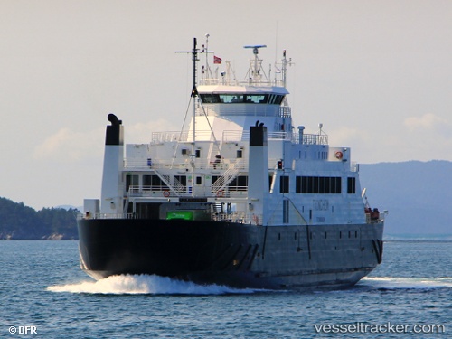
 Trondheim
Current Status
Where is the vessel?
Trondheim is currently in Near Bosberg, based on AIS data received about 1h ago.
Latest AIS update:
Current position: 63.45175° N, 10.20165° E (Near Bosberg)
Average speed (last 7 days): Loading…
Average speed (last 30 days): Loading…
Vessel profile: Trondheim is a Passenger Ro Ro Cargo Ship with dimensions 97m x 16m.
This page combines live AIS, route history, probable destination signals, nearby traffic, and port activity for practical vessel monitoring.
The current position of vessel Trondheim is 63.45175 lat / 10.20165 lng. Updated: 2026-04-29 20:03:28 UTCNearest reference points:
- Near Trondheim
- Near Leksvik
- Near Hommelvik
Currently sailing under the flag of Norway ![]()
Details:
Live Vessel Trondheim Analytics (details, animations, etc.)
Recent AIS points (UTC):
2026-04-29 16:03:37 UTC · 63.45708, 10.20311 · SOG 11.5 kn · COG 337°2026-04-29 18:00:18 UTC · 63.45153, 10.20232 · SOG 0.6 kn · COG -1°
2026-04-29 19:51:07 UTC · 63.46202, 10.19290 · SOG 13.5 kn · COG -1°
2026-04-29 20:03:28 UTC · 63.45175, 10.20165 · SOG 0.3 kn · COG 220°