 vesseltracker.com
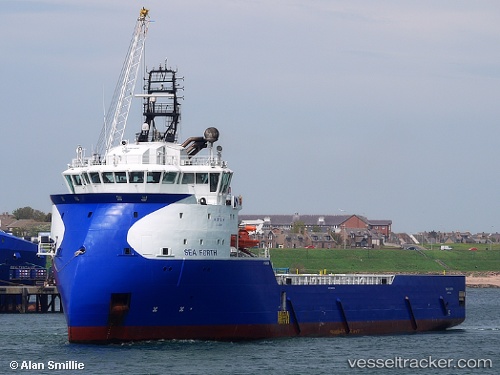
 FORTH TIDE
Current Status
Where is the vessel?
FORTH TIDE is currently in 19 nm E of Captain Field, based on AIS data received about 1h ago.
Latest AIS update:
Current position: 58.32721° N, 1.12782° W (19 nm E of Captain Field)
Average speed (last 7 days): Loading…
Average speed (last 30 days): Loading…
Vessel profile: FORTH TIDE is a Offshore Supply Ship with dimensions m x m.
This page combines live AIS, route history, probable destination signals, nearby traffic, and port activity for practical vessel monitoring.
The current position of vessel FORTH TIDE is 58.32721 lat / -1.12782 lng. Updated: 2026-04-27 23:21:36 UTCNearest reference points:
- Near Peterhead
- Near PETERHEAD
- Near Aberdeen
Currently sailing under the flag of Norway ![]()
Details:
Live Vessel FORTH TIDE Analytics (details, animations, etc.)
Recent AIS points (UTC):
2026-04-27 18:51:04 UTC · 59.03264, -0.63039 · SOG 10.5 kn · COG 200°2026-04-27 21:41:54 UTC · 58.56090, -0.96566 · SOG 10.3 kn · COG 201°
2026-04-27 22:57:03 UTC · 58.37235, -1.09358 · SOG 7.1 kn · COG 203°
2026-04-27 23:21:36 UTC · 58.32721, -1.12782 · SOG 7.2 kn · COG 203°