 vesseltracker.com
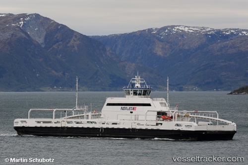
 Ampere
Current Status
Where is the vessel?
Ampere is currently in Near Brekke, based on AIS data received less than 1h ago.
Latest AIS update:
Current position: 61.05494° N, 5.50342° E (Near Brekke)
Average speed (last 7 days): Loading…
Average speed (last 30 days): Loading…
Vessel profile: Ampere is a Passenger Ro Ro Cargo Ship with dimensions 80m x 22m.
This page combines live AIS, route history, probable destination signals, nearby traffic, and port activity for practical vessel monitoring.
The current position of vessel Ampere is 61.05494 lat / 5.50342 lng. Updated: 2026-05-14 11:39:30 UTCNearest reference points:
- Near Eivindvik
- Near Eikefjord
- Near Valestrandsfossen
Currently sailing under the flag of Norway ![]()
Details:
Live Vessel Ampere Analytics (details, animations, etc.)
Recent AIS points (UTC):
2026-05-14 08:27:21 UTC · 61.05495, 5.50343 · SOG 0 kn · COG 308°2026-05-14 10:12:47 UTC · 61.10280, 5.50452 · SOG 9.2 kn · COG 202°
2026-05-14 10:41:50 UTC · 61.05496, 5.50344 · SOG 0 kn · COG 308°
2026-05-14 11:39:30 UTC · 61.05494, 5.50342 · SOG 0 kn · COG 128°