 vesseltracker.com
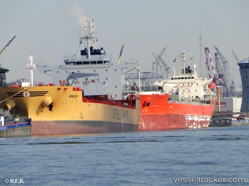
 BOW ELM
Current Status
Where is the vessel?
BOW ELM is currently in Near Johor, based on AIS data received less than 1h ago.
Latest AIS update:
Current position: 1.43292° N, 103.90092° E (Near Johor)
Average speed (last 7 days): Loading…
Average speed (last 30 days): Loading…
Vessel profile: BOW ELM is a Chemical/Oil Products Tanker with dimensions 183m x 32m.
This page combines live AIS, route history, probable destination signals, nearby traffic, and port activity for practical vessel monitoring.
The current position of vessel BOW ELM is 1.43292 lat / 103.90092 lng. Updated: 2026-04-23 21:53:30 UTCNearest reference points:
- Near Johor
- Near PASIR GUDANG
- Near CHANGI
Currently sailing under the flag of Norway (NIS) ![]()
BOW ELM built in 2011 year
Deadweight:
46098 tDetails:
Live Vessel BOW ELM Analytics (details, animations, etc.)
Recent AIS points (UTC):
2026-04-23 17:53:34 UTC · 1.43292, 103.90096 · SOG 0 kn · COG 278°2026-04-23 19:23:34 UTC · 1.43290, 103.90092 · SOG 0 kn · COG 278°
2026-04-23 19:59:32 UTC · 1.43291, 103.90094 · SOG 0 kn · COG 278°
2026-04-23 21:53:30 UTC · 1.43292, 103.90092 · SOG 0 kn · COG 278°