 vesseltracker.com
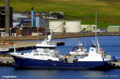
 Ronja Commander
Current Status
Where is the vessel?
Ronja Commander is currently in Near CORPACH, based on AIS data received about 1d ago.
Latest AIS update:
Current position: 56.84093° N, 5.13591° W (Near CORPACH)
Average speed (last 7 days): Loading…
Average speed (last 30 days): Loading…
Vessel profile: Ronja Commander is a Fish Carrier with dimensions 55m x 55m.
This page combines live AIS, route history, probable destination signals, nearby traffic, and port activity for practical vessel monitoring.
The current position of vessel Ronja Commander is 56.84093 lat / -5.13591 lng. Updated: 2026-04-10 07:22:33 UTCNearest reference points:
- Near Barcaldine
- Near DUNSTAFFNAGE
- Near OBAN
Currently sailing under the flag of Norway ![]()
Details:
Live Vessel Ronja Commander Analytics (details, animations, etc.)
Recent AIS points (UTC):
2026-04-10 02:34:45 UTC · 56.84098, -5.13577 · SOG 0 kn · COG 247°2026-04-10 04:19:43 UTC · 56.84099, -5.13577 · SOG 0 kn · COG 246°
2026-04-10 05:19:40 UTC · 56.84101, -5.13575 · SOG 0 kn · COG 247°
2026-04-10 07:22:33 UTC · 56.84093, -5.13591 · SOG 0 kn · COG 245°