 vesseltracker.com
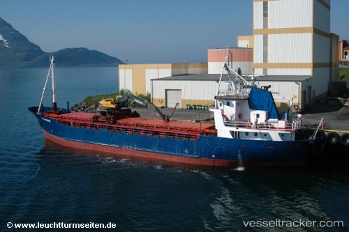
 Roslagen
Current Status
Where is the vessel?
Roslagen is currently in Near Lutelandet, based on AIS data received less than 1h ago.
Latest AIS update:
Current position: 61.31164° N, 5.05389° E (Near Lutelandet)
Average speed (last 7 days): Loading…
Average speed (last 30 days): Loading…
Vessel profile: Roslagen is a General Cargo Ship with dimensions m x m.
This page combines live AIS, route history, probable destination signals, nearby traffic, and port activity for practical vessel monitoring.
The current position of vessel Roslagen is 61.31164 lat / 5.05389 lng. Updated: 2026-05-02 22:50:58 UTCNearest reference points:
- Near Solund
- Near Eivindvik
- Near Eikefjord
Currently sailing under the flag of Norway ![]()
Roslagen built in 1970 year
Deadweight:
589 tDetails:
Live Vessel Roslagen Analytics (details, animations, etc.)
Recent AIS points (UTC):
2026-05-02 19:29:48 UTC · 61.07318, 4.99299 · SOG 5.8 kn · COG 34°2026-05-02 19:56:01 UTC · 61.11074, 5.02921 · SOG 5.4 kn · COG 1°
2026-05-02 21:45:58 UTC · 61.25612, 4.91664 · SOG 5 kn · COG 358°
2026-05-02 22:50:58 UTC · 61.31164, 5.05389 · SOG 5.6 kn · COG 58°