 vesseltracker.com
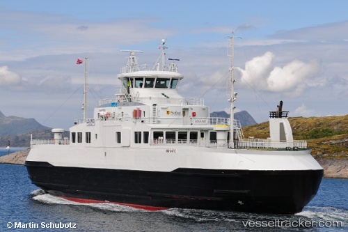
 Lovund
Current Status
Where is the vessel?
Lovund is currently in Near STRAUMOYVALEN, based on AIS data received about 1h ago.
Latest AIS update:
Current position: 66.43989° N, 12.50332° E (Near STRAUMOYVALEN)
Average speed (last 7 days): Loading…
Average speed (last 30 days): Loading…
Vessel profile: Lovund is a Passenger Ro Ro Cargo Ship with dimensions 72m x 16m.
This page combines live AIS, route history, probable destination signals, nearby traffic, and port activity for practical vessel monitoring.
The current position of vessel Lovund is 66.43989 lat / 12.50332 lng. Updated: 2026-04-24 14:02:08 UTCNearest reference points:
- Near STRAUMOYVALEN
- Near Lurøy
- Near Træna
Currently sailing under the flag of Norway ![]()
Details:
Live Vessel Lovund Analytics (details, animations, etc.)
Recent AIS points (UTC):
2026-04-24 10:56:52 UTC · 66.50176, 12.10323 · SOG 0 kn · COG -1°2026-04-24 11:33:54 UTC · 66.50179, 12.10320 · SOG 0 kn · COG -1°
2026-04-24 13:41:15 UTC · 66.47357, 12.30813 · SOG 14.4 kn · COG -1°
2026-04-24 14:02:08 UTC · 66.43989, 12.50332 · SOG 14.7 kn · COG -1°