 vesseltracker.com
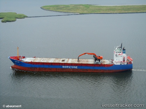
 Norvind
Current Status
Where is the vessel?
Norvind is currently in Near Brake, based on AIS data received about 2h ago.
Latest AIS update:
Current position: 53.33944° N, 8.49410° E (Near Brake)
Average speed (last 7 days): Loading…
Average speed (last 30 days): Loading…
Vessel profile: Norvind is a Multi Purpose Carrier with dimensions 110m x 15m.
This page combines live AIS, route history, probable destination signals, nearby traffic, and port activity for practical vessel monitoring.
The current position of vessel Norvind is 53.33944 lat / 8.49410 lng. Updated: 2026-04-07 01:25:46 UTCNearest reference points:
- Near Brake
- Near Sandstedt
- Near Bremerhaven
Currently sailing under the flag of Norway ![]()
Norvind built in 2002 year
Deadweight:
5916 tDetails:
Live Vessel Norvind Analytics (details, animations, etc.)
Recent AIS points (UTC):
2026-04-06 19:41:04 UTC · 53.64185, 8.42112 · SOG 9.6 kn · COG 122°2026-04-06 21:45:59 UTC · 53.38128, 8.49737 · SOG 9.3 kn · COG 174°
2026-04-06 23:29:39 UTC · 53.33944, 8.49421 · SOG 0 kn · COG 202°
2026-04-07 01:25:46 UTC · 53.33944, 8.49410 · SOG 0 kn · COG 203°