 vesseltracker.com
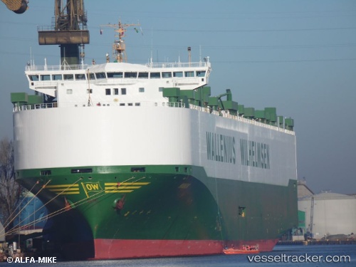
 MANON
MANON
Current Status
Where is the vessel?
MANON is currently in Near Spiekeroog, based on AIS data received about 2h ago.
Latest AIS update:
Current position: 53.91466° N, 7.72355° E (Near Spiekeroog)
Average speed (last 7 days): Loading…
Average speed (last 30 days): Loading…
Vessel profile: MANON is a Vehicles Carrier with dimensions m x m.
This page combines live AIS, route history, probable destination signals, nearby traffic, and port activity for practical vessel monitoring.
The current position of vessel MANON is 53.91466 lat / 7.72355 lng. Updated: 2026-04-28 13:36:38 UTCNearest reference points:
- Near Wangerooge
- Near Helgoland
- Near Horumersiel
Currently sailing under the flag of Norway ![]()
Details:
Live Vessel MANON Analytics (details, animations, etc.)
Recent AIS points (UTC):
2026-04-28 10:48:59 UTC · 53.56953, 8.54957 · SOG 0 kn · COG 183°2026-04-28 11:25:17 UTC · 53.58924, 8.52091 · SOG 9.1 kn · COG 330°
2026-04-28 13:28:38 UTC · 53.88857, 7.76606 · SOG 16.6 kn · COG 302°
2026-04-28 13:36:38 UTC · 53.91466, 7.72355 · SOG 16 kn · COG 332°