 vesseltracker.com
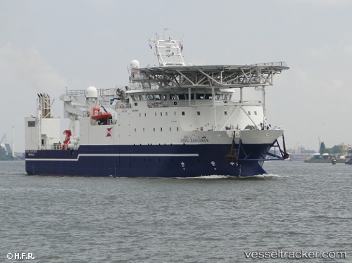
 Stril Explorer
Current Status
Where is the vessel?
Stril Explorer is currently in 54 nm N of Cidade de Angra dos Reis FPSO, based on AIS data received less than 1h ago.
Latest AIS update:
Current position: 24.68833° S, 42.50333° W (54 nm N of Cidade de Angra dos Reis FPSO)
Average speed (last 7 days): Loading…
Average speed (last 30 days): Loading…
Vessel profile: Stril Explorer is a Offshore Support Vessel with dimensions 76m x 16m.
This page combines live AIS, route history, probable destination signals, nearby traffic, and port activity for practical vessel monitoring.
The current position of vessel Stril Explorer is -24.68833 lat / -42.50333 lng. Updated: 2026-05-14 19:46:09 UTCNearest reference points:
- 69 nm NE of Cidade de Angra dos Reis FPSO
- 34 nm S of Cidade de Angra dos Reis FPSO
- 49 nm S of SEPETIBA
Currently sailing under the flag of Norway ![]()
Stril Explorer built in 2010 year
Deadweight:
1400 tDetails:
Live Vessel Stril Explorer Analytics (details, animations, etc.)
Recent AIS points (UTC):
2026-05-14 16:28:13 UTC · -24.68500, -42.49833 · SOG 0 kn · COG -1°2026-05-14 17:43:12 UTC · -24.68500, -42.49833 · SOG 0 kn · COG -1°
2026-05-14 19:25:11 UTC · -24.68833, -42.50333 · SOG 0 kn · COG -1°
2026-05-14 19:46:09 UTC · -24.68833, -42.50333 · SOG 0 kn · COG -1°