 vesseltracker.com
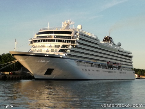
 Viking Sky
Current Status
Where is the vessel?
Viking Sky is currently in Near Whitehead, based on AIS data received less than 1h ago.
Latest AIS update:
Current position: 54.71512° N, 5.68098° W (Near Whitehead)
Average speed (last 7 days): Loading…
Average speed (last 30 days): Loading…
Vessel profile: Viking Sky is a Cruise Ship with dimensions 228m x 34m.
This page combines live AIS, route history, probable destination signals, nearby traffic, and port activity for practical vessel monitoring.
The current position of vessel Viking Sky is 54.71512 lat / -5.68098 lng. Updated: 2026-05-13 18:08:08 UTCNearest reference points:
- Near Belfast
- Near Crossgar
- Near Southend
Currently sailing under the flag of Norway ![]()
Details:
Live Vessel Viking Sky Analytics (details, animations, etc.)
Recent AIS points (UTC):
2026-05-13 13:49:48 UTC · 54.62650, -5.88435 · SOG 0 kn · COG 37°2026-05-13 15:43:48 UTC · 54.62650, -5.88436 · SOG 0 kn · COG 37°
2026-05-13 16:22:48 UTC · 54.62650, -5.88436 · SOG 0 kn · COG 36°
2026-05-13 18:08:08 UTC · 54.71512, -5.68098 · SOG 13.9 kn · COG 28°