 vesseltracker.com
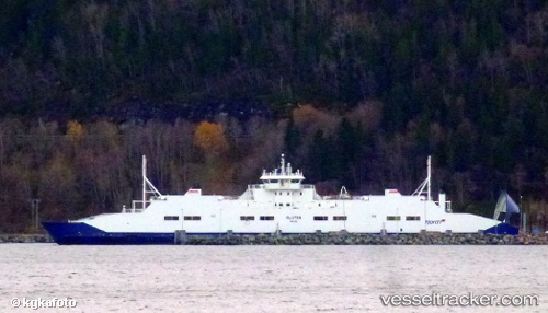
 Glutra
Current Status
Where is the vessel?
Glutra is currently in Near Bognes, based on AIS data received less than 1h ago.
Latest AIS update:
Current position: 68.24191° N, 16.21553° E (Near Bognes)
Average speed (last 7 days): Loading…
Average speed (last 30 days): Loading…
Vessel profile: Glutra is a Passenger Ro Ro Cargo Ship with dimensions 122m x 16m.
This page combines live AIS, route history, probable destination signals, nearby traffic, and port activity for practical vessel monitoring.
The current position of vessel Glutra is 68.24191 lat / 16.21553 lng. Updated: 2026-05-01 13:55:51 UTCNearest reference points:
- Near Harstad
- Near Sigerfjord
- Near Hammerfall
Currently sailing under the flag of Norway ![]()
Glutra built in 2000 year
Deadweight:
659 tDetails:
Live Vessel Glutra Analytics (details, animations, etc.)
Recent AIS points (UTC):
2026-05-01 10:59:12 UTC · 68.23313, 16.23527 · SOG 0 kn · COG 191°2026-05-01 11:29:52 UTC · 68.22539, 16.07660 · SOG 0.1 kn · COG 204°
2026-05-01 13:31:45 UTC · 68.24044, 16.23503 · SOG 10.4 kn · COG 128°
2026-05-01 13:55:51 UTC · 68.24191, 16.21553 · SOG 11 kn · COG 264°